The Mud Korea Decided to Save: Getbol and the UNESCO Vote in Busan
The least Instagrammable thing Korea could nominate — a coastline of mud — is a UNESCO World Heritage site, and on July 25, 2026, in the one year Korea controlled the room, it was made bigger. A guide to getbol: the flats that feed millions of migrating birds, the women who ride wooden sleds across them, and why a country that once paved its tidal flats now enshrines them.
At the 48th session of the UNESCO World Heritage Committee — held in Busan from July 19–29, 2026, the first time Korea has ever hosted — the delegates voted on a Korean nomination. It was not a palace, a temple, or a fortress. It was mud. And on July 25, they approved it.
Specifically, it's 갯벌 (getbol) — the vast tidal flats of Korea's west and south coasts, the expanse of mud and sand that the sea uncovers twice a day and swallows again. Korea inscribed them as a World Heritage site in 2021, and on July 25, 2026, the committee agreed to make the protected area bigger.
That a country would fight to enshrine its mudflats — the least scenic, least monetizable coastline it has — is the whole story. Here's what getbol is, why it matters enough to defend at the UN's heritage table, and why Korea, which spent the late 20th century paving its tidal flats over, changed its mind.
The Vote, and What's Actually Changing
The 2021 inscription, "Getbol, Korean Tidal Flats," covered four component sites totalling 128,411 hectares. What Korea brought to Busan was a boundary extension — officially "Phase II" — that the 2021 committee itself had asked Korea to prepare.
Per the primary UNESCO documentation, the extended property would comprise six components — Boseong-Suncheon-Yeosu-Goheung, Shinan-Muan Tandoman, Muan Hamhaeman, Gochang, Seocheon, and Seosan — totalling 156,386 hectares, a roughly 22% expansion (WHC/26/48.COM/8B). IUCN, the expert body that evaluates natural sites, recommended approval. (One correction to the wire copy circulating on the day: it's six components, not seven. Several outlets ran a list that reads as seven by splitting the Shinan-Muan Tandoman cluster; the primary document is unambiguous.)
Two things worth setting straight up front. First, because this extends an existing site rather than adding a new one, it does not give Korea an 18th World Heritage site — the national count stays at 17 (15 cultural, 2 natural). Second, the vote is now in, and it passed.
The result (July 25, 2026): The committee approved the extension. Getbol is now a serial property of six components — Boseong-Suncheon-Yeosu-Goheung (15,809 ha), Shinan-Muan Tandoman (117,570 ha), Muan Hamhaeman (4,200 ha), Gochang (5,531 ha), Seocheon (6,809 ha), and Seosan (6,467 ha) — for a total inscribed area of 156,386 hectares, up from 128,411, with the buffer zone growing from 80,508 to 105,303 hectares. The newly protected flats are at Yeosu, Goheung, Muan, and Seosan. The adopted area matches the IUCN recommendation exactly. Procedurally it went through as a "significant boundary modification" — the formal mechanism for enlarging a site already on the list, and, per Korean heritage-service coverage, the first time Korea has used it. Because this extends the 2021 property rather than adding a new one, Korea's World Heritage total stays at 17. (Component areas from the IUCN evaluation, WHC/26/48.COM/INF.8B2; decision and totals per same-day Korean coverage — Korea Herald, Korea Times.)
What a Getbol Actually Is
갯벌 is a native Korean word — 갯 (of the tide) plus 벌 (open plain) — for a tidal flat: the mud-and-sand plain exposed at low tide and drowned at high tide. Korea's sit in the eastern Yellow Sea, which UNESCO's citation calls "one of the world's largest and most productive tidal flat ecosystems."
What makes them globally exceptional is a specific accident of geography: the Yellow Sea is macro-tidal (enormous tidal range) and semi-enclosed, and Korea's rivers feed it a steady supply of sediment. That combination builds and endlessly rebuilds a mosaic of flat types — estuarine, open-bay, archipelago, semi-enclosed — each hosting different life. The 2021 listing records some 2,150 species, including 47 endemic to the Yellow Sea and five endangered marine invertebrates, and it was inscribed under criterion (x) — the biodiversity criterion (UNESCO).
Crucially, UNESCO's own citation frames getbol as a coupled natural-and-human system — a landscape that "demonstrates the dependence of cultural diversity and human activity on the natural environment." Which is the part that makes this Korea's story and not a nature documentary.
The Birds: A Refuel Stop on a Hemisphere-Long Flight
The reason a mudflat matters this much is invisible for most of the year: it's a gas station on one of the planet's great migration routes.
The East Asian–Australasian Flyway runs from the Russian Arctic and Alaska down through East and Southeast Asia to Australia and New Zealand, across 22 countries, and it carries over 50 million migratory waterbirds (BirdLife). Millions of them stake their survival on the Yellow Sea's tidal flats, where they stop to gorge on shellfish and worms before the next leg of a journey that can span the globe.
The flagship is the spoon-billed sandpiper (넓적부리도요) — a tiny wader with an absurd, spatula-tipped bill, critically endangered, with a 2024 estimate of only around 440 mature birds left and falling. When a species that small and that rare depends on your mud, the mud stops being wasteland.
There is also a genuine success story in the same flats: the black-faced spoonbill (저어새) was down to under 300 birds in the late 1980s and, as of 2025, its global population surpassed 7,000 — a recovery so real that a downlisting of its threat status has been proposed. Getbol is one of the places that comeback happened.
And for anyone inclined to see mud as economically worthless, Korea's Ministry of Oceans and Fisheries valued the ecosystem services of the inscribed flats — water purification, disaster buffering, carbon storage — at roughly 9.2 trillion won a year (Korea Herald).
The Women Who Ride the Mud
Here's what a nature reserve doesn't usually have: workers.
Getbol is not wilderness. It's a working landscape, farmed by hand for centuries, and two of its practices carry Korea's formal Nationally Important Fisheries Heritage designation.
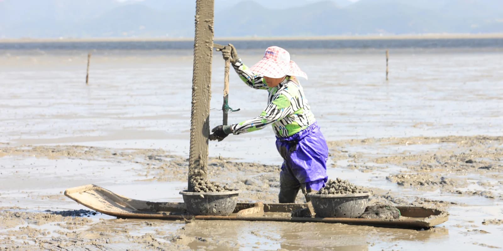
The most striking is the 뻘배 (ppeolbae) — a single wooden plank, like a one-runner sled, that a harvester kneels on and pushes across the soft mud with one leg, gathering cockles in the tidal bay off Boseong. It's exhausting, ingenious, and unmistakable, and Boseong's mud-sled fishery is Nationally Important Fisheries Heritage No. 2 (No. 1 is the Jeju haenyeo, the diving women). Up the coast in Shinan and Muan, harvesters hunt octopus barehanded in the flats — a separate heritage-listed practice, and the source of the region's famous thin-legged 낙지.
The flats are managed on the ground by 어촌계, village fishing cooperatives that self-govern who harvests what and when. That's the detail that turns this from a fenced-off reserve into living heritage: the getbol is somebody's workplace, and has been for generations. The mud feeds birds and people, and the nomination leans on exactly that.
Down in Beolgyo, in Boseong, the cockle (꼬막) is practically a literary character — the town anchors Jo Jung-rae's epic novel The Taebaek Mountains, and its cockle harvest, pulled from these flats, is nationally famous.
Why Korea Changed Its Mind
To understand why Korea is defending its mud, you have to know what it did to it first.
The cautionary tale has a name: 새만금 (Saemangeum). Beginning in the 1990s, Korea built the world's longest sea wall — 33 kilometers — to seal off a vast estuary for reclamation, converting hundreds of square kilometers of tidal flats into land. The wall closed in 2006, and the shellfish beds behind it died within weeks. It became Korea's longest-running environmental fight and the emblem of everything World Heritage status is meant to prevent.
The turn away from the Saemangeum era is real and legislated: Korea's 2019 Tidal Flat Act halted further reclamation and funded restoration. Phase II — the extension the committee approved on July 25 — is Korea doubling down on that reversal, on the very coast where it once did the opposite. Around Seosan, one of the newly added areas, a tidal-power plant was pushed for years before being scrapped in 2016 in favor of designating the bay a marine protected area. The country that paved its mud is now inscribing it.
There's a fitting piece of symbolism in the timing. At this same Busan session, the committee adopted the Busan Declaration, adding "collaboration" as a new strategic objective — the first such expansion in nearly two decades — with Korea, for the first time, chairing the room where these decisions get made.
If You Want to Stand on One
Getbol is surprisingly visitable — carefully.
- Suncheon Bay (순천만) is the accessible masterpiece: boardwalks out into a sea of reeds, the famous S-curve tidal channel best seen at sunset from the Yongsan Observatory, and wintering cranes. The adjacent Suncheon Bay National Garden makes it a full day. (Note: Suncheon Bay is also a Ramsar wetland, a separate designation from the World Heritage boundary.)
- Shinan's "1,004 Islands" include the viral Purple Islands, where two tidal-flat islands are connected by lavender-painted bridges — the archipelago-type getbol as a day out.
- Boseong / Beolgyo pairs the flats with a cockle meal, best in winter.
- Gochang and Seocheon offer the quieter, birdwatching end of the experience.
One rule that isn't optional: a getbol is walkable only at low tide, and the incoming tide over flat mud moves fast and far. Check the tide tables, stay on the marked boardwalks or with a guide, and never wander out onto open mud alone.
The Point
Korea has spectacular things to show the world — palaces, fortress walls, volcanic islands. Of all of them, the one it chose to press at the UN's heritage table in the year it hosts is a coastline of mud.
That choice says something. A getbol is not scenic in the postcard sense; its value is in what it does — feed a hemisphere of migrating birds, filter the sea, store carbon, and support the hand-harvesters who've worked it for centuries. To protect it, you have to be able to see worth in something that looks, at low tide, like an empty brown plain.
Korea spent one era failing that test at Saemangeum. In Busan, on July 25, it made the opposite case official — that the least Instagrammable coastline it owns is exactly the one worth saving.
The extension was approved on July 25, 2026, reported here from same-day Korean coverage; at the time of writing UNESCO's own property page had not yet been updated to the new boundaries, which typically follows a session by some weeks. Hectare figures and the six-component structure are taken from the primary UNESCO/IUCN evaluation documentation for the session, and the component areas sum to the stated total. Species and valuation figures are dated and sourced in-text, with the black-faced spoonbill's proposed downlisting noted as proposed rather than adopted. We note explicitly that this is a boundary extension, not a new inscription, so Korea's site count remains 17. Images: hero — the Suncheon Bay S-curve at sunset, by the Korea Heritage Service (국가유산청, formerly 문화재청), KOGL Type 1 via Wikimedia Commons (cropped); cover — a harvester on a 뻘배 mud-sled gathering shellfish, CC BY-SA 4.0 via Wikimedia Commons (cropped); listing card — the saltmarsh and tidal channels at Gochang, by the Korea Heritage Service (국가유산청, formerly 문화재청), KOGL Type 1 via Wikimedia Commons (cropped).
Keep Reading
More Stories

황사 Is Not 미세먼지: What Korea's Air Quality Alerts Actually Mean
English coverage treats yellow dust and fine dust as the same problem. Korea's own forecasters subtract one from the other before publishing. A guide to the two seasons, the alert thresholds, what KF94 actually certifies, and why 'it all comes from China' is a number swap.
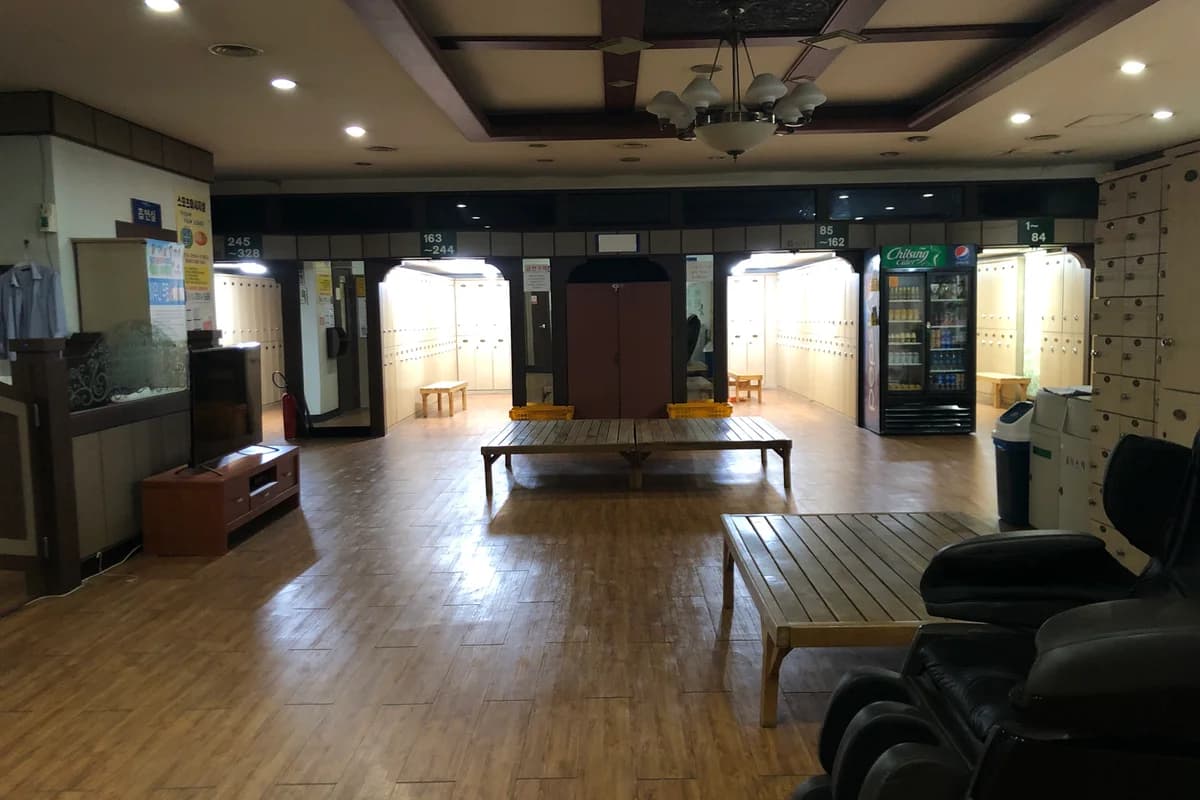
Jjimjilbang for First-Timers: How Korea's Bathhouses Actually Work
Yes, the bath part is fully nude. No, nobody cares. A step-by-step guide to the Korean spa-sauna-sleepover — the sheep-head towel, the scrub that removes a layer of you, which famous venues have quietly closed — and why the neighborhood bathhouse is disappearing even as the tourist jjimjilbang thrives.

Do You Tip in Korea? The Honest Answer
Short version: no. Korea doesn't have a tipping culture — not at restaurants, cafes, or taxis — and you're not being rude by not tipping. Here's the honest, reassuring guide: why Korea doesn't tip, the one 'service charge' you'll see and shouldn't panic about, the rare times a tip is okay, and what actually happens if you try.
The Weekly Dispatch
Korea, curated. Every week.
The best of K-culture, straight from Seoul. Written by people who actually live here.
Free, no spam, unsubscribe whenever.